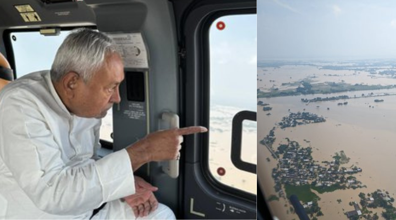
Nitish Kumar conducted the aerial survey of flood-affected regions.
Photo Credit: The Suncity News
.

Patna, October 1, 2024: Nitish Kumar, the Chief Minister of Bihar, conducted the aerial survey of the flood-affected area of the North Bihar and Seemanchal region on Tuesday.
CM Nitish Kumar was joined by Water Resource Minister Vijay Kumar Chaudhary and Additional Chief Secretary Pratyay Amrit.
The flooding is the result of unprecedented rainfall in Nepal’s catchment areas over the past week, which led to the release of large amounts of water from the Valmikinagar Gandak Barrage and Kosi Barrage.
Nitish Kumar inspected the survey after the water was released from different barrages:
On September 27, authorities released 5.49 lakh cusecs of water from the Kosi Barrage located at Virpur block, while 6.61 lakh cusecs of water were released on September 29.
Similarly, 5.01 lakh cusecs of water were released from Valmikinagar Gandak Barrage on September 27, and 5.62 lakh cusecs of water were released on September 29.
This has caused severe flooding in districts like West Champaran, East Champaran, Gopalganj, Sitamarhi, Sheohar, Supaul, Madhubani, Darbhanga, Muzaffarpur, Araria, Purnea, Kishanganj and Katihar.
Over 10 lakh people have been affected, with many seeking refuge on railway platforms, national, and state highways. The floods have been exacerbated by breaches in embankments in several districts.
In Sitamarhi, the Bagmati River has broken embankments in the Belsand and Runni Saidpur blocks, with further breaches in Kharauha, Rupauli and Madhkaul villages. Similarly, in Sheohar district, an embankment along the Bagmati River at Tariyani Chhapra has collapsed, worsening the flood’s impact.
In Darbhanga, the situation has deteriorated after an embankment at Badaul village in Kiratpur block was breached due to the strong flow of water from the Kosi River.
East Champaran’s Sugauli block has also been affected by the collapse of a ring dam on the Sikrahna River near Gorigaon village, where about 30 feet of the dam built under MNREGA collapsed due to the rising water level on Monday.
Many rivers are above the danger level:
At present, the Kosi, Bagmati, Gandak, Burhi Gandak, Kamla Balan, Adhwara, Mahananda and Ganga Rivers are flowing above the danger level at multiple locations.
The Nitish Kumar government is continuing its efforts to assess and manage the flood’s impact, but the situation remains dire with ongoing breaches and rising water levels.
Also Read: The flood situation worsened in Sitamarhi, where a 35-meter embankment was broken.
EOM.


